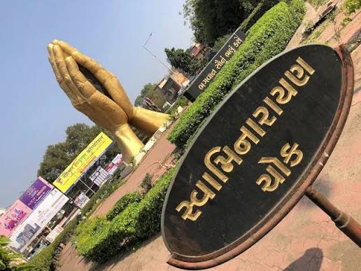
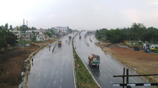
Uttarahalli Circle — also widely known as Dr. Vishnuvardhan Circle, named in honour of the legendary Kannada film actor and south Bengaluru’s most celebrated cultural icon — is one of the most important and most transit-active residential junctions in the Uttarahalli–Subramanyapura belt of southwestern Bengaluru. The circle anchors the convergence of Dr. Vishnuvardhan Road and the Uttarahalli Main Road, marking the functional heart of the Uttarahalli locality — a dense, well-established residential neighbourhood flanked by Subramanyapura, Chikkallasandra, JP Nagar, and Konanakunte, all of which funnel daily commuter traffic through this junction. Jaya Prakash Nagar Metro Station on the Green Line — approximately 1 kilometre north-east of the circle — is the nearest rapid transit access point, accessible in a 14-minute walk or a 4-minute auto-rickshaw ride. The first BMTC bus at Uttarahalli Circle (Route 210N) departs at an exceptionally early 3:30 AM and the last runs at 2:33 AM — making it one of the few residential circles in south Bengaluru with genuine near-24-hour bus service, a testament to the enormous daily commuter demand generated by the workers, students, and professionals of this large southwestern neighbourhood.
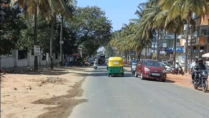
Uttarahalli Circle Location
- Address: Uttarahalli Circle (Dr. Vishnuvardhan Circle), Dr. Vishnuvardhan Road / Uttarahalli Main Road, Uttarahalli, Bengaluru — 560061, Karnataka
- Pin Code: 560061
- STD Code: 080
- Administrative Zone: Uttarahalli Ward / Subramanyapura Ward — BBMP South Zone
| Reference Point | Distance |
| Uttarahalli Bus Stand | 277 metres — 4-minute walk |
| Subramanyapura Police Station | 303 metres — 5-minute walk |
| KR Hospital, Uttarahalli | 442 metres — 7-minute walk |
| Jaya Prakash Nagar Metro Station (Green Line) | 1 kilometre — 14-minute walk |
| Konanakunte Cross Metro Station (Green Line) | 2.95 kilometres |
| Yelachenahalli Metro Station (Green Line) | 3.67 kilometres |
| Kempegowda Bus Station (Majestic) | 10 kilometres |
| KSR Bengaluru City Railway Station | 10 kilometres |
| Banashankari TTMC | 4 kilometres |
| JP Nagar | 3 kilometres |
| Kempegowda International Airport | 35 kilometres |
Directions to Uttarahalli Circle
From Kempegowda Bus Station (Majestic)
Take BMTC Route 210-N or 210-E southward via Banashankari → continue on Dr. Vishnuvardhan Road → Uttarahalli Circle approximately 10 kilometres — 25 to 40 minutes by BMTC bus or auto-rickshaw.
From KSR Bengaluru City Railway Station
Take Mysore Road or Kanakapura Road southward → connect to Banashankari → take Route 210 series southward → approximately 10 kilometres — 30 to 45 minutes.
From Jaya Prakash Nagar Metro Station (Green Line)
Exit Metro → take auto-rickshaw or 14-minute walk southward → Uttarahalli Circle. Approximately 4 to 5 minutes by auto.
From Banashankari TTMC
Take BMTC Route 210-N or 375 series southward → approximately 4 kilometres — 10 to 15 minutes.
From JP Nagar (3rd or 4th Phase)
Take Uttarahalli Road westward → approximately 3 kilometres — 8 to 12 minutes.
Road Connectivity
| Road | Direction | Connectivity |
| Dr. Vishnuvardhan Road | North toward JP Nagar / South toward Subramanyapura | JP Nagar (north) — Subramanyapura, Kengeri–Uttarahalli Road (south) |
| Uttarahalli Main Road | East toward Chikkallasandra | Chikkallasandra, Doddakallasandra, Uttarahalli–Kengeri Main Road |
| Uttarahalli–Kengeri Main Road | West toward Kengeri | Kengeri TTMC, Kengeri Metro, Mysore Road |
| Subramanyapura Road | North–East | Banashankari zone, Padmanabhanagar |
| 15E Road connector | East | JP Nagar 3rd Phase, Sarakki |
| NICE Road (via connector) | South | NICE Expressway — Electronic City, BTM Layout |
BMTC Bus Connectivity
| BMTC Route | Service Details |
| Route 210N / 210-N | Via Uttarahalli Circle — first bus 3:30 AM, last 2:33 AM — near-24-hour service |
| Route 210EA / 210-E / 210-TA | Via Uttarahalli Circle — multiple 210-series services connecting city and south Bengaluru |
| Route 210-D / 210-H / 210-WA / 210-NA | Via Uttarahalli Circle zone — multiple variants |
| Route 210-NB / 210-ND / 210-TP | Via Uttarahalli Circle — Kempegowda (KBS) to Uttarahalli corridor |
| Route 375 / 375-D / 375-J / 375-H / 375-G | Via Uttarahalli — Banashankari to Turahalli forest and Bidadi direction |
| Route 378 / 378-A | Via Uttarahalli — Kengeri TTMC to Electronic City — via Uttarahalli zone |
| Route 15-E | Via Uttarahalli zone — south city service |
| Route MF-375D / MF-375H / MF-378 / MF-44 | Metro Feeder routes connecting Uttarahalli Circle to Jaya Prakash Nagar Metro Station |
| Route 500-A / 500-CA | Via Uttarahalli zone — 500-series express |
First BMTC bus: Route 210N at 3:30 AM. Last BMTC bus: Route 210N at 2:33 AM.
Metro Connectivity
| Station | Line | Distance | Notes |
| Jaya Prakash Nagar Metro Station | Green Line | 1 km — 14-minute walk | Nearest Metro — Metro Feeder MF-375D/H/378/MF-44 connect |
| Konanakunte Cross Metro Station | Green Line | 2.95 km | Second-nearest Metro — southward Green Line |
| Yelachenahalli Metro Station | Green Line | 3.67 km | Southern Green Line terminus — Silk Institute |
First Green Line Metro near Uttarahalli Circle: 7:04 AM. Last Green Line Metro: 11:56 PM. The Metro Feeder routes MF-375D, MF-375H, MF-378, and MF-44 provide direct BMTC feeder connectivity between Uttarahalli Circle and Jaya Prakash Nagar Metro Station.
Railway Connectivity
| Station | Distance | Line | Notes |
| KSR Bengaluru City Railway Station | 10 km | All lines | Main Bengaluru terminus |
| Nayandahalli Railway Station | 6 km | Mysore–Bengaluru passenger line | Nearest suburban halt |
Nearby Areas and Landmarks
| Landmark / Area | Distance | Description |
| Uttarahalli Bus Stand | 277 metres | BMTC bus stand — primary transit hub in the locality |
| Subramanyapura Police Station | 303 metres | Neighbourhood police station |
| KR Hospital, Uttarahalli | 442 metres | Government hospital — primary healthcare access |
| Dr. Vishnuvardhan Circle (same junction) | At the circle | Named for the legendary Kannada film actor — cultural identity of the locality |
| St. Anthony’s Church, Uttarahalli | Adjacent | Heritage church — a local landmark |
| JP Nagar | 3 km | One of Bengaluru’s most popular residential neighbourhoods |
| Turahalli Forest | 3 km | Reserved forest — mountain biking and trekking zone |
| Banashankari Temple | 4 km | One of Bengaluru’s most revered temples — major pilgrimage site |
| National Public School, Uttarahalli | Nearby | Reputed CBSE school in the Uttarahalli zone |
Frequently Asked Questions (FAQs)
Q1. Where is Uttarahalli Circle located in Bengaluru?
Uttarahalli Circle is at the junction of Dr. Vishnuvardhan Road and Uttarahalli Main Road, Uttarahalli, southwestern Bengaluru — PIN 560061 — also known as Dr. Vishnuvardhan Circle.
Q2. Why is Uttarahalli Circle also called Dr. Vishnuvardhan Circle?
The circle is named in honour of Dr. Vishnuvardhan — the celebrated Kannada film actor and cultural icon — who lived in this area and has an enormous following in south and western Bengaluru.
Q3. Which Metro station is nearest to Uttarahalli Circle?
Jaya Prakash Nagar Metro Station on the Green Line is approximately 1 kilometre away — a 14-minute walk or 4-minute auto-rickshaw ride — with Metro Feeder routes MF-375D, MF-375H, MF-378, and MF-44 connecting both points.
Q4. Which BMTC routes serve Uttarahalli Circle?
Routes 210N, 210EA, 210-E, 210-TA, 210-WA, 375-D, 375-J, 378, 15-E, and all Metro Feeder MF-375 and MF-44 routes serve Uttarahalli Circle. Route 210N operates near-24-hours from 3:30 AM to 2:33 AM.
Q5. How far is Banashankari TTMC from Uttarahalli Circle?
Approximately 4 kilometres via Dr. Vishnuvardhan Road — 10 to 15 minutes by BMTC Route 210-N or auto-rickshaw.