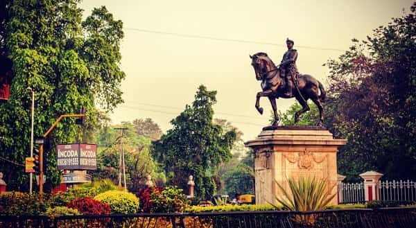
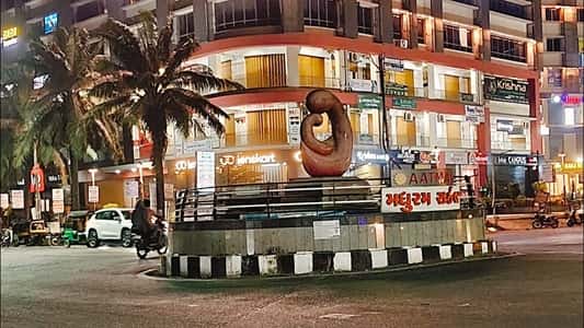
Tapovan Circle — the significant roundabout junction on the Sardar Patel Ring Road (SP Ring Road) in Sughad, on the Ahmedabad–Gandhinagar border — is one of north Ahmedabad’s most strategically positioned intersections, sitting precisely at the point where the SP Ring Road crosses the Gandhinagar–Ahmedabad highway corridor (TP-44 zone) near the Tapovan Ashram that gives the circle its name. Located in the PIN code zone 382424, and adjacent to the emerging residential belt of Sughad, Koteswar, and Motera, Tapovan Circle is both a critical SP Ring Road transit node and the daily navigation landmark for the thousands of residents, students, and professionals who live in the Chandkheda–Motera–Sughad–Zundal residential corridor. The circle has its own dedicated Gujarat Metro Station — Tapovan Circle Metro Station on the Yellow Line (Line 3: Motera Stadium–Sector 24) — with the first Metro departing at 8:15 AM toward Motera Stadium and the last at 8:07 PM toward Sector 24 (Gandhinagar). Narendra Modi Stadium (the world’s largest cricket stadium) is approximately 1.1 kilometres south — a defining proximity that elevates Tapovan Circle’s national visibility significantly.
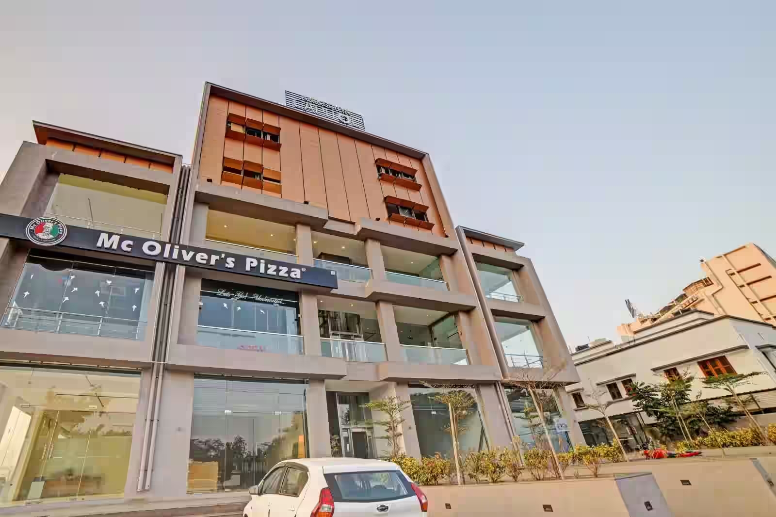
Tapovan Circle, Ahmedabad Location
Address: Tapovan Circle, Sughad Road, SP Ring Road (TP-44), Sughad, Gandhinagar District, Ahmedabad, Gujarat — 382424
Pin Code: 382424
Post Office: Sughad
STD Code: 02717
Administrative Zone: Gandhinagar South — Gandhinagar District / Sabarmati Assembly Constituency
| Reference Point | Distance |
| Tapovan Circle Metro Station (Yellow Line 3) | Adjacent — at the circle |
| Narendra Modi Stadium (Motera Stadium) | 1.1 kilometres — 15-minute walk |
| Motera Stadium Metro Station (Line 2 / Line 3) | 1.1 kilometres — 15-minute walk |
| Sabarmati Railway Station | 4 kilometres |
| GIDC Bhat | 1.4 kilometres |
| Bhat Circle | 2.3 kilometres |
| Chandkheda | 6 kilometres |
| Ahmedabad Railway Station (Kalupur) | 14 kilometres |
| Sardar Vallabhbhai Patel International Airport | 12 kilometres |
| Lal Darwaja (City Centre) | 12 kilometres |
| Zundal | 4 kilometres |
| Gandhinagar Capital | 18 kilometres |
Directions to Tapovan Circle
From Ahmedabad Railway Station (Kalupur)
Take Ashram Road northward → continue via the Sabarmati Bridge → follow the Gandhinagar–Ahmedabad Road northward toward Motera and Sughad → Tapovan Circle approximately 14 kilometres — 20 to 30 minutes by road.
From Sardar Vallabhbhai Patel International Airport
Exit onto SP Ring Road → take the northern segment toward Sughad → Tapovan Circle approximately 12 kilometres — 15 to 25 minutes.
From Gandhinagar Capital
Take the Gandhinagar–Ahmedabad Highway southwestward → approximately 18 kilometres → Tapovan Circle. 25 to 35 minutes.
From Motera / Narendra Modi Stadium
Head north on the SP Ring Road service road from the stadium → approximately 1.1 kilometres → Tapovan Circle. 3 to 5 minutes.
From Chandkheda
Take SH-41 southward → connect to SP Ring Road northbound → approximately 6 kilometres → Tapovan Circle. 10 to 15 minutes.
Road Connectivity
| Road | Direction | Connectivity |
| SP Ring Road (132 Feet Road) | North–South orbital | Naroda, Airport (north) — Vaishnodevi, Chandkheda (south) |
| Gandhinagar–Ahmedabad Road (TP-44) | East toward Gandhinagar | Bhat, Gandhinagar Sector zones, GIFT City |
| Sughad Road | West toward Sughad village | Sughad residential area |
| Koteswar Road | South toward Koteswar | Koteswar, Motera Sabarmati zone |
| Motera Road | South | Narendra Modi Stadium, Motera |
| NH-147 / SH-71 connector | East–South | Adalaj, Koba, Gandhinagar |
AMTS Bus Connectivity
| AMTS Route | Service Details |
| Route 22 | Via Tapovan Circle — cross-city service — connects Vaishnodevi Circle to Odhav and city zones |
| Route 102 | Maninagar Terminal / Lal Darwaja to Akshardham Mandir Gandhinagar — via Tapovan Circle zone |
| Route SP1SH | AMTS Special Highway Route — Tapovan Circle (S.P. Ring Road) to Ranasan Circle — first at 7:18 AM, last at 7:54 PM |
First AMTS service: Route SP1SH at 7:18 AM. Last AMTS service: Route SP1SH at 7:54 PM.
Metro Connectivity
Tapovan Circle has a dedicated Gujarat Metro Station — Tapovan Circle Metro Station on Line 3 (Yellow Line — Motera Stadium to Sector 24, Gandhinagar). This is one of the most directly Metro-accessible circles in the entire Ahmedabad–Gandhinagar Metro network.
| Metro Line | Station | First Train | Last Train | Direction |
| Line 3 (Yellow) | Tapovan Circle Metro Station | 8:15 AM toward Motera Stadium | 8:07 PM toward Sector 24 | Motera (south) — Gandhinagar Sector 24 (north) |
| Line 2 (Blue/Green) | Motera Stadium Metro Station | 6:20 AM | 9:54 PM | Accessible 15-min walk or 5-min auto |
Railway Connectivity
| Station | Distance | Line | Notes |
| Sabarmati Railway Station | 4 km | Western Railway — Sabarmati Junction | Major junction — multiple lines |
| Chandkheda Road Station | 6 km | Western Railway suburban | Northern suburban access |
| Ahmedabad Railway Station (Kalupur) | 14 km | All lines | Main Ahmedabad terminus |
Nearby Areas and Landmarks
| Landmark / Area | Distance | Description |
| Narendra Modi Stadium (Motera Stadium) | 1.1 km | World’s largest cricket stadium — 132,000 capacity |
| GIDC Bhat | 1.4 km | GIDC industrial zone east of the circle |
| Dr. M. K. Shah Medical College & Research Centre | Adjacent | Premier medical college near Tapovan Circle |
| Tapovan Ashram | Adjacent | Religious ashram from which the circle derives its name |
| Bhat Circle | 2.3 km | Secondary junction on the Gandhinagar corridor |
| Apollo Hospital (Bhat Village) | 1.3 km | Major private hospital on the Gandhinagar road |
| Chandkheda | 6 km | Residential suburb — growing IT and services belt |
| Zundal | 4 km | BRTS Zundal Circle — northern BRTS terminus |
| Sughad Residential Zone | Adjacent | Growing residential area flanking Tapovan Circle |
Frequently Asked Questions (FAQs)
Q1. Where is Tapovan Circle located in Ahmedabad?
Tapovan Circle is on the SP Ring Road (TP-44 zone), Sughad, near the Ahmedabad–Gandhinagar border — PIN 382424 — approximately 1.1 kilometres north of Narendra Modi Stadium.
Q2. Is there a Metro station at Tapovan Circle?
Yes. Tapovan Circle Metro Station on Gujarat Metro Yellow Line (Line 3 — Motera Stadium to Sector 24, Gandhinagar) is directly at the circle — first Metro at 8:15 AM, last at 8:07 PM.
Q3. How far is Narendra Modi Stadium from Tapovan Circle?
Approximately 1.1 kilometres south — a 15-minute walk or 3-minute auto-rickshaw ride.
Q4. Which AMTS routes serve Tapovan Circle?
Routes 22, 102, and SP1SH serve the circle. SP1SH (Special Highway Route to Ranasan Circle) runs from 7:18 AM to 7:54 PM.
Q5. Which railway station is nearest to Tapovan Circle?
Sabarmati Railway Station is approximately 4 kilometres south — the nearest major junction station.
Q6. How far is Gandhinagar from Tapovan Circle?
Approximately 18 kilometres via the Gandhinagar–Ahmedabad Road — accessible directly by Metro Line 3 toward Sector 24.
Q7. What is the SP Ring Road near Tapovan Circle?
The SP Ring Road (132 Feet Road) is Ahmedabad’s full orbital highway — passing through Tapovan Circle and connecting north Ahmedabad (Airport, Naroda) to the western and southern city zones (Sarkhej, Narol, Vatva).
Q8. What is the Tapovan Ashram near the circle?
Tapovan Ashram is the religious institution from which Tapovan Circle takes its name — an ashram in the Sughad zone that has been a landmark of this north Ahmedabad corridor for several decades.