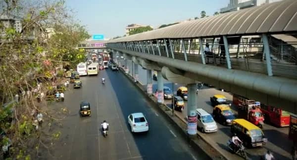
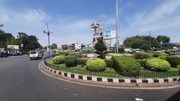
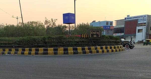
Sarkhej Circle — the prominent roundabout cluster at the convergence of the Sarkhej–Gandhinagar Highway, the Sarkhej–Bavla Road, and the Sarkhej–Sanand Road in the Sarkhej–Makarba–Vejalpur zone of southwestern Ahmedabad — is one of the city’s most strategically important outer-ring highway junctions, anchoring the entire southwestern transit corridor of greater Ahmedabad. Sarkhej is more precisely a cluster of closely adjacent circles — with the Sarkhej–Gandhinagar Highway Circle (also called Sanand Circle or the SG Highway intersection), the Ujala Circle (Sarkhej–Bavla), and the Sarkhej–Sanand Cross Road all sitting within 500 to 800 metres of each other — creating a multi-node highway transit zone rather than a single standalone roundabout. The Ujala Hotel, which lends its name to the popular Ujala Circle (Sarkhej Bavla Circle), is a landmark hospitality facility adjacent to the junction. Sarkhej is also home to one of India’s most important and revered heritage sites — the Sarkhej Roza — a 15th-century mosque-tomb complex in the nearby Makarba village that is considered a masterpiece of Gujarati-Islamic architecture and one of the most significant Sufi heritage monuments in South Asia. The Jivraj Park Metro Station on Gujarat Metro Line 2 is approximately 1.485 kilometres (19-minute walk) from the Ujala Circle / Sarkhej Railway Overbridge zone — with the first Line 2 Metro at 6:20 AM and the last at 10:32 PM. The first AMTS bus (Route 31-SH) at Sarkhej departs at 5:35 AM and the last (Route 14D) runs until 11:29 PM.
Sarkhej Circle Location
Address: Sarkhej Circle (Sarkhej–Gandhinagar Highway Circle / Ujala Circle), Sarkhej–Bavla Road / SG Highway Junction, Makarba / Vejalpur, Sarkhej, Ahmedabad, Gujarat — 382210
- Pin Code: 382210
- Post Office: Sarkhej
- STD Code: 079
- Administrative Zone: Ellis Bridge Assembly Constituency — Ahmedabad Municipal Corporation (AMC) / Ahmedabad West Lok Sabha Constituency
| Reference Point | Distance |
| Ujala Circle (Sarkhej Railway Overbridge) | At the circle — 15 metres |
| Ujala Circle (Sarkhej) | 104 metres — 2-minute walk |
| Sarkhej Bavla Circle (Ujala Hotel) | 107 metres — 2-minute walk |
| Sarkhej Railway Crossing | 882 metres — 12-minute walk |
| Sarkhej Railway Station (Sarkhej Village) | 1.32 to 1.43 kilometres |
| Jivraj Park Metro Station (Line 2 / Red Line) | 1.48 kilometres — 19-minute walk |
| Sarkhej Roza (Heritage Monument) | 1.5 kilometres |
| APMC (Agricultural Produce Market Committee) | 3.3 to 4.8 kilometres |
| Ahmedabad Railway Station (Kalupur) | 11 kilometres |
| Sardar Vallabhbhai Patel International Airport | 8 kilometres |
| Sanand | 15 kilometres |
Directions to Sarkhej Circle
From Ahmedabad Railway Station (Kalupur)
Take Ashram Road southward → continue via Paldi → follow S.G. Highway southwestward → approximately 11 kilometres — 20 to 30 minutes by AMTS or auto-rickshaw.
From Sardar Vallabhbhai Patel International Airport
Take Airport Road southward → connect to S.G. Highway → approximately 8 kilometres — 12 to 18 minutes by cab.
From Jivraj Park Metro Station (Line 2)
Exit Metro → take auto-rickshaw southwestward → approximately 1.48 kilometres — 5 to 8 minutes.
From Sarkhej Railway Station
Take auto-rickshaw northwestward → approximately 1.4 kilometres → Sarkhej Circle. 4 to 6 minutes.
From Sanand
Take SH-17 eastward toward Sarkhej → approximately 15 kilometres — 20 to 30 minutes.
Road Connectivity Sarkhej Circle
| Road | Direction | Connectivity |
| Sarkhej–Gandhinagar Highway (S.G. Highway) | Northeast toward Ahmedabad | Paldi, Vejalpur, Ahmedabad city centre |
| Sarkhej–Bavla Road | West toward Bavla | Bavla, NH-48 (Ahmedabad–Rajkot), Sanand Industrial Zone |
| Sarkhej–Sanand Road | North toward Sanand | Sanand, GIDC Sanand, Maruti Suzuki Plant |
| Makarba Road | East–Southeast | Makarba Village, Sarkhej Roza, inner zones |
| NH-48 connector | Via Sarkhej | Ahmedabad–Delhi / Ahmedabad–Mumbai National Highway |
| Jivraj Park Road | Northeast | Jivraj Park Metro zone, Vejalpur belt |
AMTS Bus Connectivity Sarkhej Circle
| AMTS Route | Service Details |
| Route 31-SH (Special Highway) | First bus at Sarkhej zone at 5:35 AM — Lal Darwaja to Sarkhej Gam — last 10:49 PM |
| Route 31 / 31/4 / 31/4-SH / 31/5 | Via Sarkhej Circle — Meghaninagar, Paldi, Lal Darwaja corridors toward Sarkhej and Sanand — Route 31/5: Lal Darwaja to Motipura Chokdi (Sanand) |
| Route 35 | Via Sarkhej Circle — Lal Darwaja to Bavla — first 5:41 AM, last 11:17 PM |
| Route 150 / 150-SH | Via Sarkhej — Chinubhai Nagar to Sarkhej Gam — Sarangpur to Sarkhej Gam (150-SH) |
| Route 14D / 14U | Via Sarkhej–Gandhinagar Highway Circle — SG Highway corridor — last bus 11:29 PM |
| Route 16D / 16S / 16E / 16U | Via Sarkhej Circle — SG Highway and BRTS corridor services |
| Route 501 | Paldi / Vaishnavdevi Circle to Sarkhej Bavla (Ujala Circle) — first 6:30 AM, last 8:30 PM |
| Route 30/2 | Vatva Railway Crossing to Sarkhej Gam — via Sarkhej |
| Route 34/3 | Via Sarkhej zone |
First AMTS service: Route 31-SH at 5:35 AM. Last AMTS service: Route 14D at 11:29 PM.
Metro Connectivity Sarkhej Circle
Jivraj Park Metro Station on Gujarat Metro Line 2 (Red Line — APMC to Motera / GIFT City) is approximately 1.48 kilometres from the Ujala Circle / Sarkhej Railway Overbridge zone — a 19-minute walk or 6-minute auto-rickshaw ride.
| Station | Line | Distance | Notes |
| Jivraj Park Metro Station | Line 2 (Red Line) | 1.48 km — 19-minute walk | Nearest Metro — Line 2 access |
First Line 2 Metro near Sarkhej: 6:20 AM. Last Line 2 Metro: 10:32 PM.
Railway Connectivity Sarkhej Circle
| Station | Distance | Line | Notes |
| Sarkhej Railway Station | 1.32 to 1.43 km | Western Railway suburban | Nearest station — suburban trains |
| Ahmedabad Railway Station (Kalupur) | 11 km | All lines | Main Ahmedabad terminus |
Nearby Areas and Landmarks Sarkhej Circle
| Landmark / Area | Distance | Description |
| Ujala Hotel | Adjacent | Hospitality landmark — gives the popular Ujala Circle / Sarkhej Bavla Circle its name |
| Sarkhej Roza | 1.5 km | 15th-century mosque-tomb complex — one of India’s finest Sufi heritage monuments — Gujarati-Islamic masterpiece |
| Sarkhej Village | Adjacent | Revenue village from which the entire circle zone takes its name |
| Makarba Village | 1 km | Historic village where Sarkhej Roza is located |
| APMC Market | 3.3 to 4.8 km | Ahmedabad Agricultural Produce Market — major wholesale hub |
| Sanand GIDC Industrial Zone | 15 km | Major industrial hub — Maruti Suzuki, Tata Motors, Ford plants |
| LJ University | 3 km | Private university in the Sarkhej–Vejalpur zone |
| Jivraj Park | 2 km | Established residential neighbourhood |
Frequently Asked Questions (FAQs)
Q1. Where is Sarkhej Circle located in Ahmedabad?
A: Sarkhej Circle is at the Sarkhej–Bavla Road / SG Highway / Sarkhej–Sanand Road junction, Makarba / Vejalpur, Sarkhej, Ahmedabad — PIN 382210 — approximately 11 kilometres southwest of Ahmedabad Railway Station.
Q2. Which Metro station is nearest to Sarkhej Circle?
A: Jivraj Park Metro Station on Gujarat Metro Line 2 (Red Line) is approximately 1.48 kilometres away — a 19-minute walk or 6-minute auto-rickshaw ride — with first Metro at 6:20 AM and last at 10:32 PM.
Q3. What is Sarkhej Roza near Sarkhej Circle?
A: Sarkhej Roza is a 15th-century mosque-tomb complex in Makarba village (1.5 km from the circle) — one of India’s most architecturally magnificent Sufi heritage monuments and a landmark of Gujarati-Islamic heritage.
Q4. Which AMTS routes serve Sarkhej Circle?
A: Routes 31-SH, 31, 31/4, 31/5, 35, 150, 150-SH, 14D, 16D, 501, and 30/2 serve the Sarkhej zone. Route 31-SH is the first at 5:35 AM and Route 14D runs until 11:29 PM.
Q5. How far is Sanand from Sarkhej Circle?
A: Approximately 15 kilometres westward via Sarkhej–Sanand Road — 20 to 30 minutes by AMTS bus or cab.