Sion Circle — the prominent roundabout junction at the heart of Sion, central Mumbai — is one of the most strategically positioned and most historically significant traffic junctions in the Mumbai Metropolitan Region. Sion (pronounced “Sai-yan” from the Marathi word “Sheev” meaning boundary) was the northern limit of old Bombay during the British colonial era, and its circle today serves as the crossing point of some of Mumbai’s most critical arterial roads — the Eastern Express Highway, Dr. Ambedkar Road, and Sion-Trombay Road — making it a vital convergence of east, central, and south Mumbai’s daily commuter flows. With the BEST Sion Bus Depot, Sion Railway Station on the Harbour Line, and Mumbai Metro Line 3 (Aqua Line) all accessible from the circle’s immediate vicinity, Sion Circle is one of central Mumbai’s most genuinely multi-modal transit nodes — a junction where suburban rail, city bus, Metro, and major highway infrastructure all converge.
Location of Sion Circle
- Address: Sion Circle, Sion, Mumbai — 400022, Maharashtra
- Pin Code: 400022
- STD Code: 022
- Administrative Zone: Sion Ward — Brihanmumbai Municipal Corporation (BMC), H/East Ward
| Reference Point | Distance |
| Sion Railway Station (Harbour Line) | 1 kilometre |
| GTB Nagar Station (Harbour Line) | 13-minute walk |
| Lokmanya Tilak Municipal General Hospital (Sion Hospital) | 1 kilometre |
| BEST Sion Depot | Adjacent |
| Eastern Express Highway | Adjacent — directly on the EEH corridor |
| Dadar | 3 kilometres |
| Kurla | 4 kilometres |
| Chunabhatti | 2 kilometres |
| BKC (Bandra Kurla Complex) | 5 kilometres |
| Chhatrapati Shivaji Maharaj International Airport | 11 kilometres |
| CST / CSMT (South Mumbai) | 12 kilometres |
| Dharavi Metro Station (Line 3) | 3 kilometres |
Directions to Sion Circle
From CST / CSMT (South Mumbai)
Take the Eastern Express Highway northward → continue through Dadar and Chunabhatti → Sion Circle is approximately 12 kilometres — 20 to 35 minutes depending on traffic.
From Dadar Railway Station
Take Tilak Road or Sion Road eastward → approximately 3 kilometres → Sion Circle. 8 to 15 minutes by BEST bus or auto-rickshaw.
From Chhatrapati Shivaji Maharaj International Airport
Take the Eastern Express Highway southward → approximately 11 kilometres → Sion Circle. 20 to 35 minutes depending on traffic.
From Kurla
Take LBS Road or Sion–Kurla Road westward → approximately 4 kilometres → Sion Circle. 10 to 20 minutes.
From Thane
Take the Eastern Express Highway southwestward → approximately 20 kilometres → Sion Circle. 30 to 50 minutes.
Road Connectivity of Sion Circle
| Road | Direction | Connectivity |
| Eastern Express Highway (EEH) | North–South spine | Thane, Mulund (north) — Dadar, CST, South Mumbai (south) |
| Dr. Ambedkar Road | West toward Dadar / Sion West | Dadar, Matunga, King’s Circle zone |
| Sion–Trombay Road | East toward Chembur, Trombay | Chembur, Ghatkopar, Eastern suburbs |
| Sion–Bandra Link Road | West toward Bandra | BKC, Bandra, Western suburbs |
| Sion–Panvel Expressway (via connector) | East–South | Navi Mumbai, Panvel, Pune highway |
| LBS Road | East toward Kurla | Kurla, Vikhroli, Ghatkopar |
BEST City Bus Connectivity of Sion Circle
| BEST Route | Service Details |
| Route 255LTD | Pratiksha Nagar Depot to JVPD Bus Station — via Sion Circle |
| Route 312 | Pratiksha Nagar Depot to Marol Depot — via Sion |
| Route 348LTD | Chunabhatti to Dahisar — via Sion Circle |
| Route 355LTD | Via Sion Circle — suburban LTD service |
| Route 27 | Rani Laxmibai Chowk Sion to Vaishali Nagar (Mulund W) |
| Route 66 | Via Sion Circle — cross-city service |
| Route A-85 | Via Sion Circle — AC service |
| Route A-351 | Via Sion Circle — AC suburban service |
| Route C-521 | Wadala Depot to Ghansoli Gharonda — via Sion |
| Route 9 | Colaba Bus Station to Antop Hill — via Sion |
| Route A-5 / A-19 / A-21 | Multiple AC routes — via Sion corridor |
| Route 181 | Antop Hill to Seepz Village — via Sion |
Nearest BEST bus stop cluster: Rani Laxmibai Chowk (Sion) — 2-minute walk from Sion Circle.
Railway Connectivity of Sion Circle
| Station | Distance | Line | Notes |
| Sion Railway Station | 1 km | Central Railway (CR) — Main Line | Main local train station for Sion |
| GTB Nagar Station | 13-minute walk | Harbour Railway (HR) | Harbour Line access — Panvel corridor |
| Chunabhatti Station | 14-minute walk from BEST Depot | Harbour Line | Southern Harbour access |
| Kings Circle Station | 10-minute walk | Central Railway Main Line | Matunga–Sion zone |
Metro Connectivity of Sion Circle
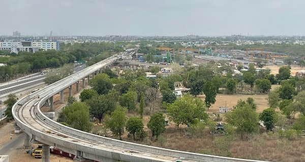
Mumbai Metro Line 3 (Aqua Line — MMRCL) provides the most significant rapid transit upgrade to the Sion zone. Dharavi Metro Station on Line 3 is approximately 3 kilometres from Sion Circle — accessible by BEST bus or auto-rickshaw — providing direct underground Metro connectivity to BKC, Bandra, CSMT, and the Cuffe Parade end of the Aqua Line. The Aqua Line’s Sion–Panvel corridor segment also has a proposed station, and metro infrastructure in the Sion zone is under active development.
Nearby Areas and Landmarks of Sion Circle
| Landmark / Area | Distance | Description |
| Lokmanya Tilak Municipal General Hospital (Sion Hospital) | 1 km | One of Mumbai’s largest and most important public hospitals |
| BEST Sion Bus Depot | Adjacent | Major BEST operational depot |
| Sion Fort | 1 km | 17th-century Portuguese colonial fort on a hilltop — heritage landmark |
| K.J. Somaiya Medical College | 1.5 km | Prominent medical college near Sion |
| Sion–Chunabhatti Market | Adjacent | Dense local commercial market zone |
| Dadar (Commercial Hub) | 3 km | Mangal Prabhat Road, Plaza Cinema, Shivaji Park area |
| BKC (Bandra Kurla Complex) | 5 km | Mumbai’s premier corporate financial district |
| Dharavi | 3 km | One of Asia’s most densely populated and economically productive urban zones |
| Matunga | 3 km | Cultural hub — South Indian restaurants, Ruia College |
Frequently Asked Questions (FAQs)
Q1. Where is Sion Circle located in Mumbai?
A: Sion Circle is in Sion, central Mumbai — PIN 400022 — at the convergence of the Eastern Express Highway, Dr. Ambedkar Road, and the Sion–Trombay Road.
Q2. Which railway station is nearest to Sion Circle?
A: Sion Railway Station on the Central Railway Main Line is approximately 1 kilometre away. GTB Nagar on the Harbour Line is a 13-minute walk.
Q3. What is the nearest BEST bus stop to Sion Circle?
A: Rani Laxmibai Chowk (Sion) is the nearest BEST stop — approximately 2 minutes’ walk from the circle, served by Routes 255LTD, 27, 312, 348LTD, 66, and others.
Q4. Is there Metro connectivity at Sion Circle?
A: Dharavi Metro Station on Mumbai Metro Line 3 (Aqua Line) is approximately 3 kilometres away. Additional Sion zone Metro stations are under development on the planned Line 11 (Anik–Gateway of India) corridor.
Q5. Which highway passes through Sion Circle?
A: The Eastern Express Highway (EEH) — Mumbai’s most important north-south arterial — passes directly through Sion Circle, connecting it to Thane, Mulund, Dadar, and South Mumbai.
Q6. How far is BKC from Sion Circle?
A: Approximately 5 kilometres via the Sion–Bandra Link Road — 15 to 25 minutes by auto-rickshaw.
Q7. What is Sion famous for historically?
A: Sion was the northern boundary (Sheev/Sion) of old Bombay during the British colonial era. The Sion Fort — built by the Portuguese in the 17th century — is the area’s most important historic landmark.
Q8. How far is Sion Hospital from Sion Circle?
A: Lokmanya Tilak Municipal General Hospital (Sion Hospital) is approximately 1 kilometre from the circle — one of Mumbai’s largest public hospitals.