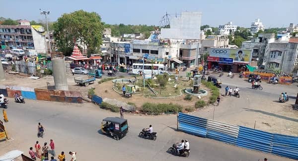
Zundal Circle — the key roundabout junction at the DCIS Circle / Zundal zone on the SP Ring Road (Sardar Patel Ring Road / 132 Feet Road) at the Ahmedabad–Chandkheda–Gandhinagar tri-junction — is one of the most strategically important transit and residential circles in north Ahmedabad’s rapidly expanding residential and educational belt. Also officially referenced as the DCIS Circle (Zundal Circle) — the “DCIS” standing for the Delhi Cantonment-style planned layouts — the circle marks the northernmost working anchor of the Ahmedabad Janmarg BRTS network’s northern corridor, with DCIS Circle (Zundal Circle) BRTS Station just 282 metres away. BRTS Route 4D (LD Engineering College to DCIS Circle, 32 stops, 49-minute journey) and Route 7D (Narol BRTS to DCIS Circle, 38 stops, 57-minute journey) both terminate at the Zundal Circle BRTS station — making it the northern terminus of Ahmedabad’s most important north-south BRTS axis. The Vishwakarma College Metro Station on Gujarat Metro Line 3 (Yellow Line) is a 2-minute walk from the adjacent Zundal Bus Stand area, confirming Zundal Circle’s multi-modal transit excellence. First bus at Zundal Circle: AMTS Route 89/1 at 5:54 AM. Last BRTS bus: Route 4D at 11:39 PM.
Zundal Circle Location
- Address: Zundal Circle (DCIS Circle), SP Ring Road (132 Feet Road), Zundal, Chandkheda, Gandhinagar District, Ahmedabad, Gujarat — 382424
- Pin Code: 382424
- Post Office: Chandkheda Society Area
- STD Code: 079
- Administrative Zone: Gandhinagar South — Gandhinagar District / Sabarmati Assembly Constituency
| Reference Point | Distance |
| DCIS Circle BRTS Station | 282 metres — 4-minute walk |
| Zundal Bus Stand | 200 metres |
| Vishwakarma College Metro Station (Line 3) | 2-minute walk from adjacent Zundal Bus Stand |
| Kalpataru Park Flats | 400 metres |
| Chandkheda (Sarathi Bunglows) | 952 metres |
| Tapovan Circle | 3.6 kilometres |
| Narendra Modi Stadium (Motera) | 4.6 kilometres |
| Ahmedabad Railway Station (Kalupur) | 15 kilometres |
| Sardar Vallabhbhai Patel International Airport | 10 kilometres |
| Gandhinagar Capital | 20 kilometres |
| Chandkheda | 2 kilometres |
| Adalaj Circle | 5 kilometres |
Directions to Zundal Circle
From Ahmedabad Railway Station (Kalupur)
Take Ashram Road northward → continue via Sabarmati → follow SP Ring Road northward via Motera and Tapovan → Zundal Circle approximately 15 kilometres — 25 to 35 minutes by road.
From Sardar Vallabhbhai Patel International Airport
Exit onto Airport Road → take SP Ring Road northward → approximately 10 kilometres → Zundal Circle. 15 to 20 minutes.
From Chandkheda
Take Chandkheda–Zundal Road southward → approximately 2 kilometres → Zundal Circle. 5 to 8 minutes.
From Tapovan Circle
Take SP Ring Road northward → approximately 3.6 kilometres → Zundal Circle. 6 to 10 minutes.
From Adalaj Circle (via NH-147)
Take NH-147 southward → connect to SP Ring Road → approximately 5 kilometres → Zundal Circle. 8 to 12 minutes.
Road Connectivity Zundal Circle
| Road | Direction | Connectivity |
| SP Ring Road (132 Feet Road) | North–South orbital | Narendra Modi Stadium, Tapovan (south) — Nana Chiloda, Airport (north-west) |
| Chandkheda–Zundal Road | North toward Chandkheda | Chandkheda Bus Stand, SH-41 (Ahmedabad–Kalol Highway) |
| Zundal Village Road | Internal | Zundal village, Vishwakarma College |
| Sarathi Bunglows Road | North | Chandkheda residential belt |
| NH-147 connector (via Adalaj) | East | Adalaj Circle, SVPI Airport, Gandhinagar |
| NH-48 (via SP Ring Road) | Via connector | Ahmedabad–Delhi National Highway |
AMTS, BRTS and Bus Connectivity Zundal Circle
| Route / Service | Service Details |
| AMTS Route 89/1 | Kalupur Terminus to Amba Township — via Zundal Circle — first bus 5:54 AM |
| AMTS Route 4D / 4E / 4U / 4S | LD Engineering College to DCIS Circle (Zundal Circle) BRTS — BRTS Route 4D first 6:00 AM (BRTS 4U), last 11:39 PM (BRTS 4D) |
| AMTS BRTS Route 7D / 7U | Narol BRTS to DCIS Circle (Zundal Circle) — 38 stops — 57-minute journey — northern BRTS terminus |
| AMTS Route 8 | Via Zundal zone — first bus at Zundal Bus Stand 6:25 AM |
| VTCOS Route 503 | Via Zundal Circle zone — VTCOS Gandhinagar service |
| VTCOS Route 109 | Via Zundal–Chandkheda corridor |
| AMTS Route 75 / 84 / 85-SH / 401 | Via Zundal–Chandkheda zone |
| AMTS SP1SH | Special Highway — via Zundal zone |
First AMTS service: Route 89/1 at 5:54 AM. Last BRTS service: Route 4D at 11:39 PM.
Metro Connectivity Zundal Circle
Zundal Circle is served by Gujarat Metro Line 3 (Yellow Line — Motera Stadium to Sector 24, Gandhinagar) — Vishwakarma College Metro Station is a 2-minute walk from the Zundal Bus Stand area adjacent to the circle. Line 2 (APMC–Motera Stadium corridor) is also accessible nearby.
| Metro Line | Station | Distance | Notes |
| Line 3 (Yellow) | Vishwakarma College Metro Station | 2-minute walk from Zundal Bus Stand | Direct access — first Metro 8:15 AM, last 8:29 PM |
| Line 2 (Blue) | Via Motera Stadium area | 4.6 km south | Accessible via auto from Zundal Circle |
Railway Connectivity Zundal Circle
| Station | Distance | Line | Notes |
| Chandkheda Road Station | 3 km | Western Railway suburban | Northern suburban access |
| Sabarmati Junction | 7 km | Western Railway — junction | Multiple lines access |
| Ahmedabad Railway Station (Kalupur) | 15 km | All lines | Main Ahmedabad terminus |
Nearby Areas and Landmarks Zundal Circle
| Landmark / Area | Distance | Description |
| Vishwakarma College | Adjacent | Engineering college — the area’s most recognised educational institution |
| Kalpataru Park Flats | 400 metres | Large residential complex directly near the circle |
| Zundal Village | Adjacent | Revenue village giving the circle its name |
| Chandkheda | 2 km | Well-developed residential suburb — growing IT and services belt |
| Narendra Modi Stadium (Motera) | 4.6 km | World’s largest cricket stadium |
| Sarathi Bunglows | 1 km | Residential enclave adjacent to the Chandkheda–Zundal corridor |
| Adalaj Stepwell | 6 km | UNESCO-recognised 15th-century heritage stepwell |
| SVPI Airport | 10 km | Direct SP Ring Road access |
Frequently Asked Questions (FAQs)
Q1. Where is Zundal Circle located in Gujarat?
A: Zundal Circle (DCIS Circle) is on the SP Ring Road (132 Feet Road), Zundal, Chandkheda, Gandhinagar District — PIN 382424 — approximately 15 kilometres from Ahmedabad Railway Station.
Q2. Is there a BRTS station at Zundal Circle?
A: Yes. DCIS Circle (Zundal Circle) BRTS Station is 282 metres away — a 4-minute walk — and serves as the northern terminus of BRTS Routes 4D (LD Engineering College–DCIS Circle, 32 stops) and 7D (Narol BRTS–DCIS Circle, 38 stops).
Q3. Which Metro station serves Zundal Circle?
A: Vishwakarma College Metro Station on Gujarat Metro Line 3 (Yellow Line) is a 2-minute walk from the adjacent Zundal Bus Stand — first Metro at 8:15 AM, last at 8:29 PM.
Q4. What does DCIS stand for in DCIS Circle (Zundal Circle)?
A: DCIS refers to the Zundal Circle’s official BRTS designation — the DCIS Circle BRTS stop is the northernmost BRTS terminus on Ahmedabad’s full north-south Bus Rapid Transit corridor.
Q5. How far is Narendra Modi Stadium from Zundal Circle?
A: Approximately 4.6 kilometres south along the SP Ring Road — 8 to 12 minutes by auto-rickshaw or AMTS bus.