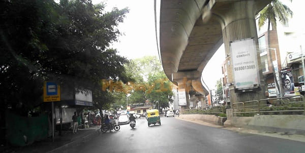
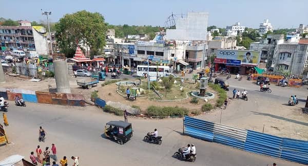
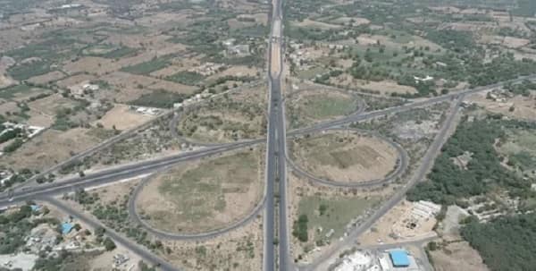
Ujala Circle — the well-known roundabout at the Sarkhej–Bavla Highway (National Highway 8C / Chiloda–Sarkhej–Santhal Road) in Sarkhej, southwestern Ahmedabad — takes its name from the prominent Ujala Hotel situated directly at the junction, whose landmark presence gave the circle its local identity. Also referenced as the Sarkhej Bavla (Ujala Circle) on the AMTS bus network, this junction sits at the convergence of the Sarkhej–Gandhinagar Highway (SG Highway), the Sarkhej–Bavla Road (NH-8C), and the internal Sarkhej roads — making it a critical southwestern Ahmedabad transit node for daily commuters, long-distance GSRTC and private bus travellers heading toward Bavla, Sanand, Botad, Bhavnagar, and the Saurashtra region, and residents of the dense Sarkhej, Jivraj Park, Makarba, and Vejalpur residential belt. The famous heritage complex of Sarkhej Roza — one of Ahmedabad’s most celebrated medieval Islamic monuments and a UNESCO World Heritage component site — is approximately 2 kilometres from Ujala Circle, making the junction a heritage tourism gateway as well.

Ujala Circle, Ahmedabad Location
Address: Ujala Circle, Sarkhej–Bavla Highway (NH-8C), Sarkhej, Ahmedabad, Gujarat — 382210
Pin Code: 382210
Post Office: Sarkhej
STD Code: 079
Administrative Zone: Sarkhej Ward — Ahmedabad Municipal Corporation (AMC) — Vejalpur Assembly Constituency
| Reference Point | Distance |
| Ujala Hotel | Adjacent — at the circle |
| Sarkhej Bavla Circle (Ujala Hotel) | Adjacent — same junction cluster |
| Sarkhej Railway Crossing | 784 metres — 11-minute walk |
| Sarkhej Railway Station | 1.3 kilometres — 17-minute walk |
| Jivraj Park Metro Station (Line 2) | 1.5 kilometres — 19-minute walk |
| Sarkhej Roza (Heritage Monument) | 2 kilometres |
| Sarkhej GSRTC Bus Stand | 1 kilometre |
| Makarba | 2 kilometres |
| Vejalpur | 2.5 kilometres |
| Ahmedabad Railway Station (Kalupur) | 15 kilometres |
| Sardar Vallabhbhai Patel International Airport | 10 kilometres |
| Sanand | 20 kilometres |
| Bavla | 28 kilometres |
Directions to Ujala Circle
From Ahmedabad Railway Station (Kalupur)
Take Ashram Road southward → continue via Paldi → follow SG Highway (Sarkhej–Gandhinagar Highway) southwestward → continue to Sarkhej → Ujala Circle approximately 15 kilometres — 25 to 40 minutes by AMTS bus or auto-rickshaw.
From Sardar Vallabhbhai Patel International Airport
Exit onto Airport Road → take NH-8A (Airport–Sarkhej connector) southward → approximately 10 kilometres → Ujala Circle. 15 to 25 minutes.
From Lal Darwaja (City Centre)
Take Relief Road → continue via Paldi → SG Highway southward → Sarkhej → approximately 14 kilometres → Ujala Circle. 20 to 35 minutes.
From Sanand
Take the Sanand–Sarkhej Road (NH-8C) eastward → approximately 20 kilometres → Ujala Circle. 25 to 35 minutes.
From Makarba
Take the Makarba–Sarkhej Road westward → approximately 2 kilometres → Ujala Circle. 5 to 8 minutes.
Road Connectivity
| Road | Direction | Connectivity |
| Sarkhej–Bavla Highway (NH-8C) | West toward Bavla, Sanand | Bavla, Sanand Industrial Estate, Botad, Bhavnagar |
| SG Highway (Sarkhej–Gandhinagar Highway) | North toward city centre | Paldi, Ashram Road, Lal Darwaja, Gandhinagar |
| Sarkhej–Sanand Cross Road | West–South | Sanand Circle, Sanand–Taluka zone |
| Jivraj Park Road | Northeast | Jivraj Park, Vejalpur residential belt |
| Makarba Road | East | Makarba, Bopal |
| NH-8A connector | North | Airport, SP Ring Road (West) |
AMTS City Bus Connectivity
| AMTS Route | Service Details |
| Route 35 | Lal Darwaja to Bavla — via Ujala Circle — first bus 5:41 AM, last 11:17 PM |
| Route 31/5 | Lal Darwaja to Motipura Chokdi (Sanand) — via Ujala Circle |
| Route 31/4 | Paldi to Kashindra Gam — via Ujala Circle |
| Route 31/4-SH | Paldi to Bakrol Gam — via Ujala Circle |
| Route 501 | Vaishnavdevi Circle to Sarkhej Bavla (Ujala Circle) — 43 stops — first 6:30 AM, last 8:30 PM |
| Route 501 | Paldi to Ujala Circle (Sarkhej) — 30 stops — first 6:10 AM, last 9:20 AM |
| Route 31-SH | First bus at Ujala Circle at 5:35 AM |
First AMTS service: Route 31-SH at 5:35 AM. Last AMTS service: Route 35 at 11:17 PM.
Metro Connectivity
Ujala Circle is served by the Ahmedabad Metro Line 2 (Blue Line) via Jivraj Park Metro Station — approximately 1.5 kilometres northeast (19-minute walk or 5-minute auto-rickshaw ride). The first Line 2 Metro near the Ujala zone starts at 6:20 AM and the last runs until 10:32 PM. Line 2 connects Jivraj Park toward APMC and Motera Stadium, providing the circle with indirect but accessible Metro connectivity.
Railway Connectivity
| Station | Distance | Line | Notes |
| Sarkhej Railway Station | 1.3 km | Western Railway — Ahmedabad suburban | Nearest station — Sarkhej zone |
| Sarkhej Railway Crossing | 784 metres — 11-min walk | Western Railway | Level crossing access point |
| Ahmedabad Railway Station (Kalupur) | 15 km | All lines | Main Ahmedabad terminus |
Nearby Areas and Landmarks
| Landmark / Area | Distance | Description |
| Ujala Hotel | Adjacent | The landmark hotel that names the circle |
| Sarkhej Roza | 2 km | UNESCO World Heritage monument — 15th-century Indo-Islamic complex |
| GSRTC Sarkhej Bus Stand | 1 km | GSRTC intercity and state highway bus stand |
| Sarkhej Railway Station | 1.3 km | Nearest railway access — Ahmedabad Western Railway |
| Jivraj Park | 1.5 km | Dense residential area — Metro-connected via Line 2 |
| Makarba | 2 km | Growing residential and commercial suburb |
| Vejalpur | 2.5 km | Established residential neighbourhood |
| LJ Institute of Engineering & Technology | 3 km | Premier private engineering college |
| Sarkhej–Raikot Highway junction | Adjacent | Key highway node for Saurashtra and Rajkot direction |
| Singoda Lake | 3 km | Natural lake near the Sarkhej–Makarba belt |
Frequently Asked Questions (FAQs)
Q1. Where is Ujala Circle located in Ahmedabad?
Ujala Circle is on NH-8C (Sarkhej–Bavla Highway), Sarkhej, southwestern Ahmedabad — PIN 382210 — at the junction of the SG Highway, Sarkhej–Bavla Road, and the Sarkhej–Sanand Cross Road.
Q2. Why is it called Ujala Circle?
Ujala Circle is named after the Ujala Hotel — a prominent and long-established hotel located directly at the junction — which became such a recognisable landmark that the entire circle adopted its name.
Q3. Which AMTS routes serve Ujala Circle?
Routes 35, 31/5, 31/4, 31/4-SH, 501, and 31-SH serve the circle. Route 35 (Lal Darwaja to Bavla) is the most extensive, running from 5:41 AM to 11:17 PM.
Q4. Which Metro station is nearest to Ujala Circle?
Jivraj Park Metro Station on Line 2 is approximately 1.5 kilometres northeast — a 5-minute auto-rickshaw ride — with first Metro at 6:20 AM and last at 10:32 PM.
Q5. How far is Sarkhej Roza from Ujala Circle?
Approximately 2 kilometres — Sarkhej Roza is one of Ahmedabad’s most important UNESCO World Heritage monument complexes, easily accessible from Ujala Circle by auto-rickshaw.
Q6. Which railway station is nearest to Ujala Circle?
Sarkhej Railway Station is approximately 1.3 kilometres — a 17-minute walk or 5-minute auto-rickshaw ride from the circle.
Q7. How far is Sanand from Ujala Circle?
Approximately 20 kilometres via NH-8C (Sarkhej–Bavla Road) westward — 25 to 35 minutes. Sanand is home to a major GIDC industrial estate including Tata Motors and other large manufacturers.
Q8. What is the AMTS Route 501 at Ujala Circle?
Route 501 is the AMTS service running between Vaishnavdevi Circle (north Ahmedabad) and Sarkhej Bavla (Ujala Circle) — covering 43 stops across the full north-to-south SG Highway corridor in approximately 52 minutes.