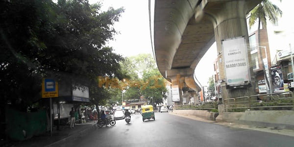
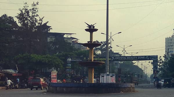
Khadakpada Circle — the central and most significant roundabout in the Khadakpada neighbourhood of Kalyan West in Thane District, Maharashtra — is the primary civic and commercial reference point of one of the Mumbai Metropolitan Region’s most rapidly growing, most family-friendly, and most strategically important western suburban residential hubs. Located in PIN 421301, Kalyan West Assembly Constituency, under the Bhiwandi Lok Sabha Constituency, the circle sits on Murbad Road and the Birla College Road / Bhoirwadi corridor — flanked by the landmark residential developments of Radha Nagar, Godrej Hill, Amrut Park, and Wayle Nagar (the earliest residential projects that brought Khadakpada to prominence in the late 1990s) and anchored commercially by D-Mart, KM Agrawal College, and Cambria International School. Kalyan Junction Railway Station — one of the Mumbai Metropolitan Region’s most important suburban junctions and a major interchange for trains bound toward North and South India — is approximately 2.2 to 3.3 kilometres from Khadakpada Circle, accessible in a 4-minute KDMT (Kalyan-Dombivli Municipal Transport) bus ride (Route 35 from Kalyan Railway Station West) or a 3-minute taxi ride. Shahad Railway Station is approximately 2.3 kilometres away. The proposed Metro Line 12 (Kalyan–Taloja) will bring Metro connectivity closer to Khadakpada Circle with the planned Kalyan APMC Market Metro Station approximately 3.4 to 4 kilometres from the circle.
Khadakpada Circle Location
- Address: Khadakpada Circle, Murbad Road / Birla College Road, Khadakpada, Kalyan West, Thane District, Maharashtra — 421301
- Pin Code: 421301
- Post Office: Kalyan City
- STD Code: 0251
- Administrative Zone: Kalyan West Assembly Constituency — Thane District, Bhiwandi Lok Sabha Constituency / Kalyan-Dombivli Municipal Corporation (KDMC)
| Reference Point | Distance |
| D-Mart, Khadakpada | Adjacent |
| Aayush Multispeciality Hospital | Adjacent |
| Radha Nagar / Godrej Hill | Adjacent |
| Shahad Railway Station | 2.3 kilometres |
| Kalyan Junction Railway Station | 2.2 to 3.3 kilometres |
| Vithalwadi Railway Station | 3.1 kilometres |
| Kalyan APMC Market Metro Station (Line 12) | 3.4 to 4 kilometres (planned) |
| Bhiwandi Road Railway Station | 11 kilometres |
| Thane | 23 kilometres |
| Navi Mumbai | 31 kilometres |
| CSMI Airport (Mumbai) | 36 kilometres |
| Samruddhi Mahamarg (Mumbai–Nagpur Expressway) | 10 kilometres |
Directions to Khadakpada Circle
From Kalyan Junction Railway Station
Exit Kalyan Station (West) → take KDMT Bus Route 35 or 9A toward Khadakpada → approximately 3.3 kilometres — 4 to 8 minutes by bus, 3 minutes by taxi. Bus departs every 15 minutes.
From Shahad Railway Station
Take auto-rickshaw westward → approximately 2.3 kilometres → Khadakpada Circle. 5 to 8 minutes.
From CSMI Airport (Mumbai)
Take cab via Eastern Express Highway → NH-61 toward Kalyan → approximately 36 kilometres — 50 to 70 minutes.
From Thane
Take NH-61 eastward via Mumbra–Kalyan Road → approximately 23 kilometres — 35 to 50 minutes.
From Vithalwadi Railway Station
Take auto-rickshaw northwestward → approximately 3.1 kilometres → Khadakpada Circle. 8 to 12 minutes.
Road Connectivity Khadakpada Circle
| Road | Direction | Connectivity |
| Murbad Road (NH-160) | East–West | Kalyan Junction (east) — Murbad, Nashik direction (north) |
| Birla College Road | North–South internal | Bhoirwadi, Godrej Park, Wayle Nagar residential zone |
| Padhga–Kalyan Road | East toward Kalyan | Kalyan Station, KDMC zone |
| NH-61 | South via Kalyan | Thane, Mumbai, Navi Mumbai |
| NH-160 (Murbad Road) | North | Murbad, Bhiwandi direction |
| Proposed Titwala Ring Road | Future | Titwala–Katai Naka–Navi Mumbai improved road access |
KDMT City Bus Connectivity Khadakpada Circle
| Route / Service | Service Details |
| KDMT Route 35 | From Kalyan Railway Station (West) to Sahajanand Chowk (near Khadakpada) — every 15 minutes — approximately 4 minutes journey — first 5:44 AM, last 11:48 PM |
| KDMT Route 9A | Via Khadakpada — first bus 5:44 AM — last 11:48 PM |
| KDMT Routes 1 / 2 / 2AC / 3 / 16 / 16A / 16B | Via Khadakpada zone — Murbad Road and Birla College Road corridor — various KDMT services |
| KDMT Route 1AC / 108AC / 108B | Via Khadakpada zone — AC services |
| Private Auto-Rickshaw | Available throughout the day — primary transit at Khadakpada Circle |
| App-Based Cab | Ola, Uber active in Khadakpada–Kalyan zone |
First KDMT bus: Route 9A at 5:44 AM. Last KDMT bus: Route 108AC at 11:48 PM. KDMT fare: ₹5 to ₹30 depending on route and distance.
Metro Connectivity Khadakpada Circle
Khadakpada does not have an operational Metro station as of 2026. The proposed Metro Line 12 (Kalyan–Taloja) — an elevated corridor through the Mumbai Metropolitan Region — includes Kalyan APMC Market Metro Station approximately 3.4 to 4 kilometres from Khadakpada Circle. Once operational, this will dramatically reduce commute time between Khadakpada and Navi Mumbai, Taloja, and the broader MMR zone. Metro Line 5 (Orange Line — Thane–Bhiwandi–Kalyan) construction is also underway and will improve connectivity from Khadakpada toward Thane.
Railway Connectivity Khadakpada Circle
| Station | Distance | Line | Notes |
| Kalyan Junction Railway Station | 2.2 to 3.3 km | Central Railway | MMR’s major junction — Kasara, Karjat lines, North and South India trains |
| Shahad Railway Station | 2.3 km | Central Railway suburban | Nearest suburban halt — closer walk/auto |
| Vithalwadi Railway Station | 3.1 km | Central Railway | Secondary suburban halt |
Kalyan Junction is one of the Mumbai Metropolitan Region’s most critical railway nodes — the point at which the Central Line splits toward Kasara and Karjat, and from which long-distance expresses toward Delhi, Bengaluru, Chennai, and Nagpur depart — making rail access from Khadakpada Circle highly strategic for both daily commuters and long-distance travellers.
Nearby Areas and Landmarks Khadakpada Circle
| Landmark / Area | Distance | Description |
| D-Mart, Khadakpada | Adjacent | Major retail superstore — primary commercial anchor at the circle |
| Aayush Multispeciality Hospital | Adjacent | Major hospital at Khadakpada Circle |
| Radha Nagar / Godrej Hill | Adjacent | Khadakpada’s first and most iconic residential developments — late 1990s landmarks |
| KM Agrawal College | 500 metres | Prominent Kalyan college — higher education hub |
| Cambria International School | 1 km | Reputed international school in the Khadakpada zone |
| Wayle Nagar | 500 metres | Residential neighbourhood adjacent to Khadakpada Circle |
| Durgadi Fort (Durgadi Killa) | 3 km | Historic fort in Kalyan — heritage tourism landmark |
| Samruddhi Mahamarg | 10 km | Mumbai–Nagpur Expressway — long-distance highway access |
Frequently Asked Questions (FAQs)
Q1. Where is Khadakpada Circle located in Kalyan?
A: Khadakpada Circle is on Murbad Road / Birla College Road, Khadakpada, Kalyan West, Thane District — PIN 421301 — adjacent to D-Mart and Aayush Hospital, approximately 2.2 to 3.3 kilometres from Kalyan Junction Railway Station.
Q2. Which railway station is nearest to Khadakpada Circle?
A: Shahad Railway Station is 2.3 kilometres away — slightly closer than Kalyan Junction (2.2 to 3.3 km). KDMT bus Route 35 connects Kalyan Station to Khadakpada in about 4 minutes, every 15 minutes.
Q3. Is there Metro connectivity at Khadakpada Circle?
A: No operational Metro yet. Metro Line 12 (Kalyan–Taloja) is proposed, with Kalyan APMC Market Metro Station expected approximately 3.4 to 4 kilometres away. Metro Line 5 (Orange Line) is also under construction toward Kalyan.
Q4. Which KDMT bus routes serve Khadakpada Circle?
A: Routes 35, 9A, 1, 2, 2AC, 3, 16, 16A, 16B, 1AC, 108AC, and 108B serve the Khadakpada zone. Route 35 departs from Kalyan Railway Station (West) every 15 minutes, taking just 4 minutes.
Q5. How far is Mumbai Airport from Khadakpada Circle?
A: Chhatrapati Shivaji Maharaj International Airport is approximately 36 kilometres — 50 to 70 minutes by cab via NH-61 and the Eastern Express Highway.