Dastan Circle — the key roundabout junction on the Sardar Patel Ring Road (SP Ring Road / 132 Feet Road) in the Dastan–Kathwada zone of Daskroi Taluka, eastern Ahmedabad — is one of the most important highway transit junctions on the SP Ring Road eastern corridor, serving as the primary road navigation landmark for the Kathwada, Nava Naroda, Nikol, and Saijpur Bogha residential and industrial belt. The circle sits at the convergence of the SP Ring Road and the Naroda–Kathwada Road — the key access corridor connecting the SP Ring Road’s eastern arc to the GIDC Kathwada industrial estate, the sprawling Nava Naroda residential developments, and the broader village clusters of Dastan Farm and Kathwada Village. AMTS Route 148, Route 56/1, Route 124, Route 125, and AMTS SP1 all serve this corridor, with the first bus at 6:30 AM (Route 56/1) and the last at 9:39 PM (Route 148). The Dastan Farm — a large party plot and banquet venue directly adjacent to the circle — and the Sardar Party Plot (SP Ring Road) approximately 500 metres away are the most recognised social landmarks of this junction.

Dastan Circle, Kathwada, Gujarat Location
Address: Dastan Circle, Sardar Patel Ring Road (SP Ring Road), Dastan, Kathwada, Nava Naroda, Daskroi Taluka, Ahmedabad, Gujarat — 382430
Pin Code: 382430
Post Office: Nava Naroda
STD Code: 079
Administrative Zone: Daskroi Taluka, Ahmedabad District — Nikol Assembly Constituency
| Reference Point | Distance |
| Dastan Farm (Party Plot) | Adjacent |
| Sardar Party Plot (SP Ring Road) | 500 metres |
| Kathwada GIDC Industrial Estate | 2 kilometres |
| Nava Naroda | 2 kilometres |
| Naroda | 4 kilometres |
| Odhav Circle | 6 kilometres |
| Vastral Gam Metro Station (Line 1) | 8 kilometres |
| Vatva Railway Station | 10 kilometres |
| Ahmedabad Railway Station (Kalupur) | 16 kilometres |
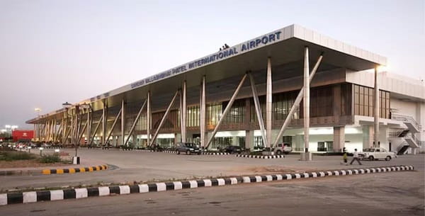
| Sardar Vallabhbhai Patel International Airport | 18 kilometres |
| Lal Darwaja (City Centre) | 14 kilometres |
| Hanspura Ring Road (SP Ring Road east terminus) | 3 kilometres |
Directions to Dastan Circle
From Ahmedabad Railway Station (Kalupur)
Take NH-47 eastward → continue via Naroda Road → connect to SP Ring Road eastern segment at the Naroda junction → follow SP Ring Road southward to the Dastan junction → approximately 16 kilometres — 25 to 40 minutes.
From Sardar Vallabhbhai Patel International Airport
Exit Airport Road → take SP Ring Road eastward and southward → continue past Naroda to Dastan zone → approximately 18 kilometres — 25 to 40 minutes.
From Odhav Circle
Take SP Ring Road northward → approximately 6 kilometres → Dastan Circle. 10 to 15 minutes.
From Naroda
Take Naroda–Kathwada Road southward → approximately 4 kilometres → Dastan Circle. 8 to 12 minutes.
From Nava Naroda
Take Kathwada Road northward → approximately 2 kilometres → Dastan Circle. 5 to 8 minutes.
Road Connectivity
| Road | Direction | Connectivity |
| SP Ring Road (132 Feet Road) | North–South orbital | Naroda (north) — Odhav, Vatva, Narol (south) |
| Naroda–Kathwada Road | West toward Naroda | Naroda GIDC, Naroda Bus Stand, Odhav zone |
| Kathwada Road | East toward Kathwada | Kathwada Village, GIDC Kathwada industrial zone |
| Dastan Farm Road | Internal | Dastan Farm, Dastan Village |
| Saijpur Bogha Road | South | Saijpur Bogha, Nikol, CTM |
| NH-47 connector (via Naroda) | Northwest | Ahmedabad–Vadodara Expressway |
AMTS City Bus Connectivity
| AMTS Route | Service Details |
| Route 56/1 | First bus at Dastan (SP Ring Road) at 6:30 AM — city corridor via Saijpur Bogha |
| Route 148 | Via Dastan Kathwada Road and SP Ring Road — first 6:59 AM (at Kathwada Road stop), last 9:39 PM |
| Route 124 | Via Dastan zone — city cross-service |
| Route 125 / 125-SH | Via Dastan Farm and Dastan Kathwada Road — Swarnim Gujarat Sports University direction |
| Route SP1 | AMTS Special — via Dastan (SP Ring Road) — first 8:49 AM, last 8:31 PM |
First AMTS service: Route 56/1 at 6:30 AM. Last AMTS service: Route 148 at 9:39 PM.
Metro Connectivity
There is no Metro station directly at Dastan Circle. The nearest Ahmedabad Metro station is Vastral Gam Metro Station on Line 1 (Blue Line) — approximately 8 kilometres away via the SP Ring Road and Vastral Road corridor — accessible by AMTS bus or auto-rickshaw. The Ahmedabad Metro Line 1 first service is at 6:20 AM and the last at 10:45 PM.
Railway Connectivity
| Station | Distance | Line | Notes |
| Vatva Railway Station | 10 km | Western Railway suburban | Nearest suburban station |
| Naroda Railway Station | 6 km | Western Railway | Suburban access north of Dastan |
| Ahmedabad Railway Station (Kalupur) | 16 km | All lines | Main Ahmedabad terminus |
Nearby Areas and Landmarks
| Landmark / Area | Distance | Description |
| Dastan Farm | Adjacent | Large party plot and banquet venue — primary commercial landmark at the circle |
| Sardar Party Plot (SP Ring Road) | 500 metres | Banquet and event venue on the Ring Road service road |
| Kathwada GIDC Industrial Estate | 2 km | GIDC industrial zone — manufacturing and packaging units |
| Nava Naroda | 2 km | Rapidly developing residential locality — apartments and plotted development |
| Vintage Village Restaurant | Adjacent | Restaurant at Dastan Farm — a local dining landmark |
| Saijpur Bogha | 3 km | Dense residential and industrial zone |
| Naroda GIDC | 4 km | Major GIDC industrial estate |
| CTM Char Rasta | 6 km | Important Naroda zone junction on the Ring Road |
| Odhav GIDC | 6 km | Ahmedabad’s oldest chemical and pharma GIDC estate |
Frequently Asked Questions (FAQs)
Q1. Where is Dastan Circle located in Gujarat?
Dastan Circle is on the SP Ring Road (132 Feet Road), Dastan, near Kathwada, Nava Naroda, Daskroi Taluka, Ahmedabad — PIN 382430 — at the junction of the Ring Road and Naroda–Kathwada Road.
Q2. Which AMTS routes serve Dastan Circle?
Routes 56/1, 124, 125, 125-SH, 148, and SP1 serve the Dastan zone. Route 56/1 is the first bus at 6:30 AM and Route 148 runs until 9:39 PM.
Q3. Is there Metro connectivity at Dastan Circle?
There is no Metro station at Dastan Circle. The nearest Metro is Vastral Gam Station on Line 1 — approximately 8 kilometres away — accessible by auto-rickshaw or AMTS bus.
Q4. What industries are near Dastan Circle?
Kathwada GIDC Industrial Estate is approximately 2 kilometres east — housing manufacturing, packaging, and processing units. Naroda GIDC and Odhav GIDC are also accessible within 4 to 6 kilometres via the SP Ring Road.
Q5. How far is Naroda from Dastan Circle?
Approximately 4 kilometres north via the Naroda–Kathwada Road — 8 to 12 minutes by AMTS bus or auto-rickshaw.