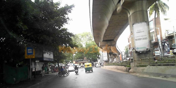
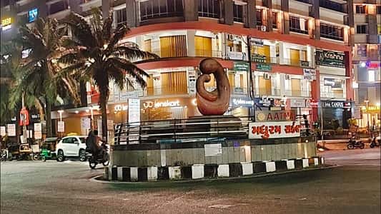
Odhav Circle — the prominent roundabout junction in the Adinath Nagar area of Odhav, eastern Ahmedabad — is one of the city’s most industrially significant and most transit-active intersections on the Sardar Patel Ring Road (SP Ring Road) corridor. The circle serves as the primary navigation reference for the Odhav GIDC Industrial Estate — one of Ahmedabad’s oldest and most densely packed chemical, pharmaceutical, engineering, and textiles manufacturing clusters — and as the gateway junction for the Odhav–Vastral residential expansion corridor stretching toward the eastern fringes of the city. Positioned at the convergence of Odhav Road and the SP Ring Road approach, the circle is served by Ahmedabad Metro Line 1 (Vastral Gam Metro Station — 19-minute walk), the AMTS city bus network, and the Ahmedabad BRTS (Janmarg) — with the Odhav Talav BRTS and SP Ring Road Approach BRTS stations within easy walking distance. The first AMTS service at the circle arrives at 5:52 AM (Route 143-SH) and the last departs at 11:46 PM (Route 150-SH), giving the junction a near-18-hour daily public transit window.
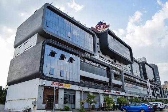
Location
- Address: Odhav Circle, Adinath Nagar, Odhav Road, Odhav, Ahmedabad, Gujarat — 382415 / 380038
- Pin Code: 382415 / 380038
- Post Office: Odhav
- STD Code: 079
- Administrative Zone: Odhav Ward — East Zone, Ahmedabad Municipal Corporation (AMC) — Vatva Assembly Constituency
| Reference Point | Distance |
| Odhav GIDC Industrial Estate | Adjacent |
| SP Ring Road Approach BRTS | 133 metres — 2-minute walk |
| Odhav Talav BRTS | 254 metres — 4-minute walk |
| Odhav Cross Road | 68 metres — 1-minute walk |
| Vastral Gam Metro Station (Line 1) | 1.45 kilometres — 19-minute walk |
| Vatva Railway Station | 6 kilometres |
| Naroda GIDC Industrial Estate | 5 kilometres |
| Ahmedabad Railway Station (Kalupur) | 14 kilometres |
| Sardar Vallabhbhai Patel International Airport | 22 kilometres |
| Lal Darwaja (City Centre) | 12 kilometres |
| Anjanaa Chowk | 914 metres |
| Vastral | 3.25 kilometres |
Directions to Odhav Circle
From Ahmedabad Railway Station (Kalupur)
Take Lal Darwaja Road eastward → continue on NH-47 / Ahmedabad–Vadodara Highway → follow the SP Ring Road eastern corridor toward Odhav → Odhav Circle approximately 14 kilometres — 25 to 40 minutes by AMTS bus or auto-rickshaw.
From Sardar Vallabhbhai Patel International Airport
Exit onto SP Ring Road → take the eastern segment southward → continue toward Naroda and Odhav exit → Odhav Circle approximately 22 kilometres — 30 to 45 minutes.
From Lal Darwaja (City Centre)
Take the Ahmedabad–Gandhinagar Highway or Naroda Road eastward → connect to the SP Ring Road at the Naroda junction → continue southward to Odhav → approximately 12 kilometres — 20 to 30 minutes.
From Vastral
Take Vastral Road westward → approximately 3.25 kilometres → Odhav Circle. 8 to 12 minutes.
From Vatva GIDC
Take Vatva–Odhav Road northward → approximately 6 kilometres → Odhav Circle. 12 to 18 minutes.
Road Connectivity
| Road | Direction | Connectivity |
| SP Ring Road (132 Feet Road) | North–South orbital | Naroda (north) — Vatva, Narol (south) |
| Odhav Road | West toward city | Lal Darwaja, Kalupur, city centre |
| Odhav Ring Road | Internal — east | Odhav GIDC Phase 2 and 3, Vastral corridor |
| Odhav–Vastral Road | East toward Vastral | Vastral Gam, Khokhra, eastern Ahmedabad |
| NH-47 / NH-48 connector | West | Ahmedabad–Vadodara Expressway |
| Naroda–Odhav Road | North toward Naroda | Naroda GIDC, Naroda Bus Stand |
AMTS City Bus Connectivity
| AMTS Route | Service Details |
| Route 11U / 11D | Via Odhav Circle — Lal Darwaja to Odhav corridor — first bus 5:52 AM |
| Route 2U / 2D | Via Odhav Circle — city cross-service |
| Route 150 / 150-SH | Via Odhav Circle — last bus 11:46 PM |
| Route 143 / 143-SH | Via Odhav Circle — first bus 143-SH at 5:52 AM |
| Route 148 | Via Odhav — city service |
| Route 33 | Via Odhav Circle — cross-city |
| Route 69 / 69-SH | Via Odhav Circle — multiple variants |
| Route 6E / 7E / 8E | E-series via Odhav — eastern corridor routes |
| Route 6S | Via Odhav — special service |
| Route 106 / 107 | Via Odhav — Naroda corridor |
| Route SP1 | Via Odhav zone |
| Route 146/1 | Via Odhav — cross-city connector |
First AMTS service: Route 143-SH at 5:52 AM. Last AMTS service: Route 150-SH at 11:46 PM.
BRTS (Janmarg) Connectivity
| BRTS Stop | Distance | Routes |
| SP Ring Road Approach BRTS | 133 metres — 2-min walk | BRTS Routes 2D / 2U — Narol to Chandkheda corridor |
| Odhav Talav BRTS | 254 metres — 4-min walk | BRTS Routes 2D / 2U — first 6:01 AM, last 11:32 PM |
| Odhav Fire Station BRTS | 400 metres | BRTS — Naroda–Narol BRTS corridor |
Metro Connectivity
Odhav Circle is served by Ahmedabad Metro Line 1 (Blue/Purple Line). Vastral Gam Metro Station is the nearest operational Metro station — approximately 1.45 kilometres east (19-minute walk or 5-minute auto-rickshaw ride). The first Metro Line 1 service near the Odhav zone starts at 6:20 AM and the last runs until 10:45 PM.
Railway Connectivity
| Station | Distance | Line | Notes |
| Vatva Railway Station | 6 km | Western Railway suburban | Nearest station — Vatva GIDC industrial workers |
| Maninagar Railway Station | 10 km | Western Railway Main Line | Major suburban station |
| Ahmedabad Railway Station (Kalupur) | 14 km | All lines | Main Ahmedabad terminus |
Nearby Areas and Landmarks
| Landmark / Area | Distance | Description |
| Odhav GIDC Industrial Estate | Adjacent | Chemical, pharma, textiles, engineering — one of Ahmedabad’s oldest industrial clusters |
| Odhav Talav (Lake) | 254 metres | Natural water body — recreational and heritage landmark |
| Anjanaa Chowk | 914 metres | Secondary commercial junction |
| Vastral | 3.25 km | Growing residential and metro-connected suburb |
| Naroda GIDC | 5 km | Second major industrial estate in northeast Ahmedabad |
| Vatva GIDC | 6 km | One of Gujarat’s largest GIDC industrial estates |
| LJ Institute of Engineering & Technology | 8 km | Premier private engineering college |
| Kankaria Lake | 14 km | Iconic Ahmedabad recreational destination |
Frequently Asked Questions (FAQs)
Q1. Where is Odhav Circle located in Ahmedabad?
Odhav Circle is in Adinath Nagar, Odhav, eastern Ahmedabad — PIN 382415 — at the junction of Odhav Road and the SP Ring Road (132 Feet Road).
Q2. Which Metro station is nearest to Odhav Circle?
Vastral Gam Metro Station on Line 1 is approximately 1.45 kilometres east — a 19-minute walk or 5-minute auto-rickshaw ride.
Q3. Which AMTS routes serve Odhav Circle?
Routes 11U, 11D, 2U, 2D, 143, 143-SH, 150, 150-SH, 33, 69, 69-SH, 106, 107, 6E, 7E, 8E, and SP1 — first bus at 5:52 AM, last at 11:46 PM.
Q4. Is there BRTS at Odhav Circle?
Yes. SP Ring Road Approach BRTS is 133 metres away and Odhav Talav BRTS is 254 metres away — both a short walk from the circle.
Q5. Which railway station is nearest to Odhav Circle?
Vatva Railway Station is approximately 6 kilometres away — the nearest suburban rail access point.
Q6. What is the SP Ring Road near Odhav Circle?
The SP Ring Road (Sardar Patel Ring Road / 132 Feet Road) is Ahmedabad’s orbital highway that passes directly through the Odhav zone — connecting to Naroda (north), Vatva, Narol (south), and the Airport (west).
Q7. What industries are near Odhav Circle?
Odhav GIDC Industrial Estate is directly adjacent — one of Ahmedabad’s oldest GIDC estates, housing chemical, pharmaceutical, engineering, textile, and packaging manufacturing units.
Q8. How far is Lal Darwaja from Odhav Circle?
Approximately 12 kilometres — 20 to 30 minutes by AMTS Route 11D or auto-rickshaw via the Ahmedabad–Vadodara Highway corridor.