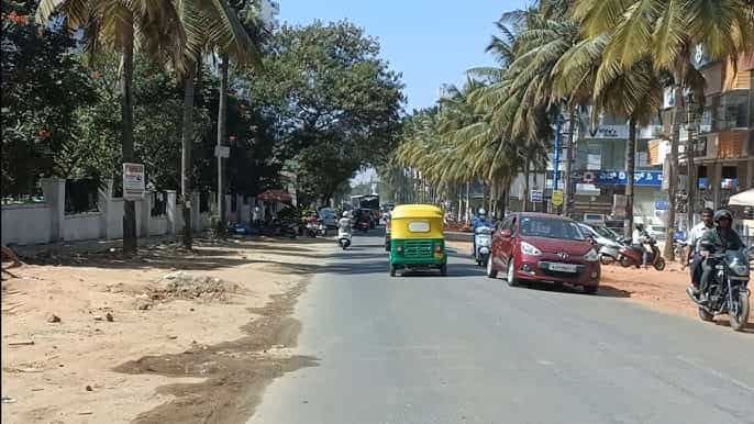
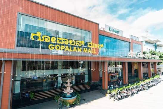
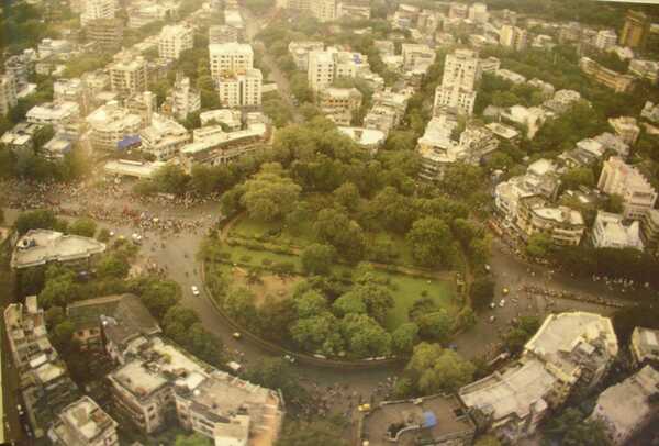
Hope Farm Circle — the key roundabout and transit junction on Whitefield Main Road in the Channasandra–Kadugodi zone of eastern Bengaluru — is the most important navigation and transit reference point in the heart of Whitefield, Bengaluru’s premier IT and technology suburb. The circle stands on Whitefield Main Road (PIN 560066) at the junction of the Channasandra Main Road and the Whitefield–Kadugodi corridor, serving as the daily convergence point for tens of thousands of IT professionals, students, residents, and service workers who live and work in the vast Whitefield technology belt — International Tech Park Bengaluru (ITPL), Brigade Tech Park, Bagmane Tech Park, RMZ Infinity, and dozens of other IT and ITES campuses that define this 18-kilometre-from-city-centre technology hub.
Hope Farm Circle is now one of Bengaluru’s most Metro-proximate IT corridor junctions — Hopefarm Channasandra Metro Station on the Purple Line is just a 5 to 6-minute walk from the circle, providing direct rapid transit connectivity to the full extent of the Purple Line from Whitefield (Kadugodi) in the east to Challaghatta in the southwest. The first Purple Line Metro at Hope Farm starts at 7:00 AM and the last runs until 12:25 AM.
Hope Farm Circle, Bengaluru Location
Address: Hope Farm Circle, Whitefield Main Road, Channasandra, Kadugodi, Bengaluru — 560066 / 560067, Karnataka
Pin Code: 560066 / 560067
STD Code: 080
Administrative Zone: Mahadevapura Zone — Bruhat Bengaluru Mahanagara Palike (BBMP)
| Reference Point | Distance |
| Hopefarm Channasandra Metro Station (Purple Line) | 6-minute walk — 422 metres |
| Whitefield (Kadugodi) Metro Station (Purple Line) | 2.06 kilometres — 27-minute walk |
| ITPL (International Tech Park Bengaluru) | 2 kilometres |
| Whitefield Railway Station (WFD) | 3 kilometres |
| Pattandur Agrahara Metro Station (Purple Line) | 1.64 kilometres |
| KSR Bengaluru City Railway Station | 22 kilometres |
| Kempegowda Bus Station (Majestic) | 20 kilometres |
| Kempegowda International Airport | 45 kilometres |
| Varthur | 4 kilometres |
| Marathahalli | 8 kilometres |
| Old Madras Road (OMR) | 5 kilometres |
Directions to Hope Farm Circle
From KSR Bengaluru City Railway Station
Take BMTC Route 305-C or 304 eastward → via Old Madras Road → continue toward Whitefield → approximately 22 kilometres — 45 to 70 minutes by BMTC or 35 to 50 minutes by cab.
From Kempegowda Bus Station (Majestic)
Board Purple Line Metro toward Whitefield (Kadugodi) → alight at Hopefarm Channasandra Metro Station → 6-minute walk to Hope Farm Circle — approximately 20 kilometres by Metro — 40 to 50 minutes total.
From Kempegowda International Airport
Take BMTC Vayu Vajra KIA-6 airport bus → directly to Hope Farm Circle — approximately 45 kilometres — 50 to 80 minutes depending on traffic. First KIA-6A at 3:33 AM, last KIA-6 at 4:01 AM (near-24-hour airport corridor).
From Marathahalli
Take Whitefield Main Road eastward → approximately 8 kilometres → Hope Farm Circle. 15 to 25 minutes.
From Whitefield (Kadugodi) Metro Station
Exit Metro → take auto-rickshaw or walk along Whitefield Main Road westward → approximately 2 kilometres (27-minute walk or 5-minute auto) → Hope Farm Circle.
Road Connectivity
| Road | Direction | Connectivity |
| Whitefield Main Road (SH-35) | East toward Whitefield / West toward Marathahalli | ITPL, Varthur, Kadugodi (east) — Marathahalli, ORR (west) |
| Channasandra Main Road | North toward Channasandra | Channasandra residential zone, Ramamurthy Nagar |
| Maithri Layout Road | Adjacent | Maithri Layout residential and IT zone |
| Kadugodi Road | East toward Kadugodi | Kadugodi, Whitefield (Kadugodi) Metro |
| Old Madras Road (NH-75) | West | Majestic, KSR Station, Whitefield Road corridor |
| Outer Ring Road (ORR) | Via Marathahalli connector | ORR — Sarjapur, HSR Layout, Hebbal |
BMTC Bus Connectivity
| BMTC Route | Service Details |
| Route 305D / 305C | Via Hope Farm Circle — first bus 4:43 AM — Majestic to Whitefield corridor |
| Route 304 / 304-B / 304-D / 304-E / 304-F | Via Hope Farm — multiple 304-series routes — city to Whitefield |
| Route 305J / 305M / 305Q / 305V | Via Hope Farm — 305-series services |
| Route 306-G / 306-M / 306 DVG-HSK | Via Hope Farm Circle — east Bengaluru corridor |
| Route 317-DS | Via Hope Farm Circle |
| Route V-335E | Vajra AC — via Hope Farm corridor |
| Route V-500F / 500-QK | Via Hope Farm — express and 500-series |
| Route 12F-5 | Via Hope Farm Main Road — cross-city |
| Route 507B | Via Hope Farm — Whitefield zone service |
| Route SBS-1K / KBS-1K | Via Hope Farm — bus station direct service |
| Route KIA-6 / KIA-6A | Vayu Vajra Airport — first 3:33 AM (KIA-6A), last 4:01 AM — near-24-hour corridor |
| Route MF-304K | Metro Feeder — last at 10:44 PM |
First BMTC bus: Route 305D at 4:43 AM. Last bus: MF-304K at 10:44 PM. First KIA Airport bus: KIA-6A at 3:33 AM.
Metro Connectivity
Hope Farm Circle is one of the most directly Metro-served IT corridor junctions in eastern Bengaluru.
| Station | Line | Distance | Notes |
| Hopefarm Channasandra Metro Station | Purple Line | 422 metres — 6-minute walk | Nearest Metro — opened 26 March 2023 |
| Pattandur Agrahara Metro Station | Purple Line | 1.64 km | Second-nearest Metro station westward |
| Whitefield (Kadugodi) Metro Station | Purple Line | 2.06 km | Eastern Purple Line terminus |
First Purple Line Metro at Hopefarm Channasandra: 7:00 AM. Last Purple Line Metro: 12:25 AM (12:24 AM at the station itself). The Purple Line connects Hope Farm to Majestic (interchange with Green Line) and onward to Challaghatta, covering 73 stops across the full corridor.
Railway Connectivity
| Station | Distance | Line | Notes |
| Whitefield Railway Station (WFD) | 3 km | South Western Railway | Nearest station — serves Whitefield–Kadugodi catchment |
| KR Puram Railway Station | 12 km | South Western Railway | Suburban junction — Bengaluru–Chennai line |
| KSR Bengaluru City Railway Station | 22 km | All lines | Main Bengaluru terminus |
Nearby Areas and Landmarks
| Landmark / Area | Distance | Description |
| Hopefarm Channasandra Metro Station | 422 metres | Purple Line Metro — gateway to entire Bengaluru Metro network |
| ITPL (International Tech Park Bengaluru) | 2 km | Bengaluru’s landmark IT park — IBM, TCS, Infosys, and others |
| Brigade Tech Park | 3 km | Major IT campus in the Whitefield corridor |
| Coffee Day — Hope Farm | Adjacent | Popular café at the circle — local café landmark |
| Kadugodi | 2 km | Residential and commercial locality adjacent to Whitefield |
| Varthur | 4 km | Growing residential suburb — Prestige and Embassy township zone |
| Maithri Layout | Adjacent | Dense residential colony flanking the circle |
| Pattandur Agrahara | 1.64 km | Metro-connected residential zone |
| Channasandra | 1 km | Residential neighbourhood with BBMP primary schools |
Frequently Asked Questions (FAQs)
Q1. Where is Hope Farm Circle located in Bengaluru?
A. Hope Farm Circle is on Whitefield Main Road, Channasandra, Kadugodi, eastern Bengaluru — PIN 560066 — at the junction of Whitefield Main Road (SH-35) and Channasandra Main Road.
Q2. Which Metro station serves Hope Farm Circle?
A. Hopefarm Channasandra Metro Station on the Purple Line is just 422 metres away — a 6-minute walk — with the first Metro at 7:00 AM and the last at 12:25 AM.
Q3. How far is ITPL from Hope Farm Circle?
A. International Tech Park Bengaluru (ITPL) is approximately 2 kilometres west along Whitefield Main Road — 5 to 10 minutes by auto-rickshaw.
Q4. Which BMTC routes serve Hope Farm Circle?
A. Routes 305D, 305C, 304, 306-G, 317-DS, V-335E, V-500F, SBS-1K, KIA-6, and Metro Feeder MF-304K all serve Hope Farm Circle. The KIA-6A airport bus operates from 3:33 AM — one of the earliest services in the Whitefield corridor.
Q5. How do I reach Hope Farm Circle from Majestic?
A. The fastest way is via the Purple Line Metro — board at Nadaprabhu Kempegowda Station (Majestic) and alight at Hopefarm Channasandra — approximately 40 to 50 minutes — then walk 6 minutes to Hope Farm Circle.