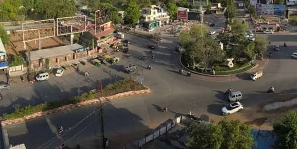
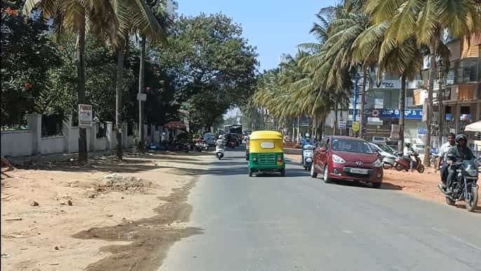
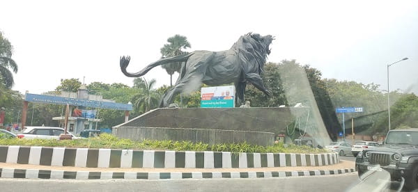
Dommasandra Circle — the principal roundabout and transit hub junction in the fast-growing Dommasandra village area of Anekal Taluka, Bengaluru Urban District — is one of southeast Bengaluru’s most strategically positioned and most BMTC-served junctions on the Sarjapur–Chandapura–Anekal growth corridor. The circle, locally identified by the BMTC bus stop at the Avadhooth Shri Guru Govardhan Swami Ashram in Dommasandra, serves as the daily navigation and commuter reference for the rapidly expanding residential township belt of Dommasandra–Muthanallur–Kodathi — an area that has attracted large residential projects including Nambiar District 25, multiple township developments, and a growing workforce from the Electronic City, Sarjapur Road, and Bommasandra IT and industrial zones. PIN code 562125 is the administrative address for the Dommasandra Circle zone, lying within the Anekal Taluka of Bengaluru Urban District, with Thigalara Chowdenahalli Cross as an adjacent transit reference. The first BMTC bus at Dommasandra Circle (Route G-2) departs at 4:14 AM — one of the earliest services in the southeast Bengaluru suburban belt — and the Vayu Vajra Airport Bus Route KIA-8D also serves the circle, providing direct airport connectivity.
Dommasandra Circle, Bangalore:Location
- Address: Dommasandra Circle, Dommasandra, Thigalara Chowdenahalli, Anekal Taluka, Bengaluru Urban District, Karnataka — 562125
- Pin Code: 562125
- STD Code: 080
- Administrative Zone: Anekal Taluka — Bengaluru Urban District / Anekal Assembly Constituency
| Reference Point | Distance |
| Dommasandra Circle Bus Stop (Avadhooth Ashram) | At the circle — 30 metres |
| Thigalara Chowdenahalli Cross | Adjacent |
| Muthanallur Cross | 2 kilometres |
| Sarjapur Circle | 6.3 kilometres |
| Bommasandra Metro Station (Yellow Line) | 14.6 kilometres |
| Electronic City Phase 1 | 10 kilometres |
| Chandapura | 10 kilometres |
| Hoskote | 30 kilometres |
| Marathahalli | 16 kilometres |
| Kempegowda Bus Station (Majestic) | 25 kilometres |
| KSR Bengaluru City Railway Station | 27 kilometres |
| Kempegowda International Airport | 45 kilometres |
Directions to Dommasandra Circle
From Kempegowda Bus Station (Majestic)
Take BMTC Route V-342F or 342-F directly from Kempegowda Bus Station → via Mysore Bank, Silk Board, Kodathi Gate, Muthanallur Cross → Dommasandra Circle approximately 25 kilometres — 50 to 70 minutes.
From Electronic City
Take BMTC Route 500-CD or 399-D northeastward → approximately 10 kilometres → Dommasandra Circle. 20 to 30 minutes.
From Sarjapur Circle
Take Route 342-A, 342-H, or V-342F westward → approximately 6.3 kilometres → Dommasandra Circle. 12 to 18 minutes.
From Marathahalli
Take BMTC Route 327-A (direct Marathahalli to Dommasandra Circle) → approximately 16 kilometres — 30 to 45 minutes.
From Bommasandra
Take Route 399-D (Heelalige Cross to Dommasandra Circle) → approximately 14.6 kilometres — 25 to 35 minutes.
Road Connectivity
| Road | Direction | Connectivity |
| Chandapura–Dommasandra Road (CD Road) | West toward Chandapura | Chandapura, Electronic City Phase 2, Attibele |
| Dommasandra–Sarjapur Road | East toward Sarjapur | Sarjapur Circle, Kodathi, Carmelaram zone |
| Dommasandra–Muthanallur Road | North | Muthanallur Cross, Marathahalli corridor |
| Dommasandra–Hoskote Road | East | Hoskote, Whitefield via alternate route |
| NICE Road (via Chandapura) | South | NICE Expressway — Mysore Road, Tumkur Road |
| Anekal Road | South | Anekal town, Attibele border zone |
BMTC Bus Connectivity
| BMTC Route | Service Details |
| Route G-2 | First bus at Dommasandra Circle at 4:14 AM — G-series express via Sarjapur to Trinity Circle, KBS zone |
| Route 342-F / V-342F | Kempegowda Bus Station to Sarjapur — via Dommasandra Circle — 36 stops (V-342F: 38 trips per day) |
| Route 342-A / 342-H / 342-MA | Via Dommasandra Circle — Sarjapur corridor variants |
| Route 327-A / 327-C | Dommasandra Circle to Marathahalli — direct service — 327A: direct route |
| Route 328-H / 328-HB | Hoskote Bus Stand to Attibele via Dommasandra — 62 stops (328H: 46 trips per day) |
| Route 399-D | Dommasandra to Chandapura / Heelalige Cross — 08:20 AM to 05:15 PM |
| Route 399-F | Via Dommasandra Circle |
| Route 500-CD | Via Dommasandra Circle — 500-series express |
| Route 12F-5 | Via Dommasandra Circle — 12F-series service — 48 trips daily |
| Route KIA-8D | Vayu Vajra Airport Bus — via Dommasandra Circle — direct airport service |
| Route KIA-8H | Last Vayu Vajra Airport Bus at 4:25 AM |
| Route V-500VA / V-500HS | Vajra AC services via Dommasandra Circle |
| Route ABS-03 | Via Dommasandra Circle — suburban shuttle |
First BMTC bus: Route G-2 at 4:14 AM. Last service: Route V-500HS at 11:49 PM.
Metro Connectivity
Dommasandra Circle does not have a Metro station directly adjacent. The nearest Metro access is via the Yellow Line (RV Road–Bommasandra) — Bommasandra Metro Station is approximately 14.6 kilometres from Dommasandra Circle, accessible by BMTC Route 399-D or private vehicle. BMTC Route G-2 provides a smarter indirect Metro linkage — riding G-2 to Trinity Circle and then boarding the Purple Line at Trinity Metro Station toward Majestic in approximately 40 to 55 minutes.
Railway Connectivity
| Station | Distance | Line | Notes |
| Heelalige Railway Station | 12 km | South Western Railway | Nearest suburban halt — Bengaluru–Hosur line |
| Carmelaram Railway Station | 14 km | South Western Railway | Suburban halt — Carmelaram–Whitefield zone |
| KSR Bengaluru City Railway Station | 27 km | All lines | Main Bengaluru terminus |
Nearby Areas and Landmarks
| Landmark / Area | Distance | Description |
| Avadhooth Shri Guru Govardhan Swami Ashram | Adjacent | Religious ashram — the BMTC bus stop naming landmark at the circle |
| Thigalara Chowdenahalli Cross | Adjacent | Secondary junction — key neighbourhood reference |
| Dommasandra Market | 500 metres | Sante Beedi Road — lively weekly local market |
| Muthanallur Cross | 2 km | Key Sarjapur Road junction — Kodathi, Carmelaram access |
| Nambiar District 25 | Nearby | Large residential township — direct access via CD Road |
| Sarjapur Circle | 6.3 km | Sarjapur Road’s main junction — commercial and residential hub |
| Electronic City Phase 1 | 10 km | Bengaluru’s flagship IT hub |
| Bommasandra KIADB Industrial Area | 14 km | Major industrial estate — auto, pharma, electronics |
Frequently Asked Questions (FAQs)
Q1. Where is Dommasandra Circle located in Bengaluru?
A. Dommasandra Circle is in Dommasandra village, Anekal Taluka, Bengaluru Urban District — PIN 562125 — on the Chandapura–Dommasandra Road and Sarjapur Road corridor, approximately 25 kilometres from Majestic.
Q2. How do I reach Dommasandra Circle from Kempegowda Bus Station?
A. Take BMTC Route V-342F or 342-F directly from Kempegowda Bus Station — 36 stops via Silk Board, Kodathi Gate, and Muthanallur Cross — approximately 50 to 70 minutes.
Q3. Which BMTC routes serve Dommasandra Circle?
A. Routes G-2, 342-F, V-342F, 342-A, 327-A, 328-H, 399-D, 500-CD, 12F-5, KIA-8D, V-500HS, and ABS-03 serve the circle. Route G-2 is the first bus at 4:14 AM and V-500HS runs until 11:49 PM.
Q4. Is there direct airport bus service from Dommasandra Circle?
A. Yes. BMTC Vayu Vajra Route KIA-8D provides direct airport bus connectivity from Dommasandra Circle to Kempegowda International Airport.
Q5. Which Metro station is nearest to Dommasandra Circle?
A. Bommasandra Metro Station on the Yellow Line is the nearest Metro — approximately 14.6 kilometres away. Route G-2 to Trinity Circle and then the Purple Line Metro provides the best indirect rapid transit option.